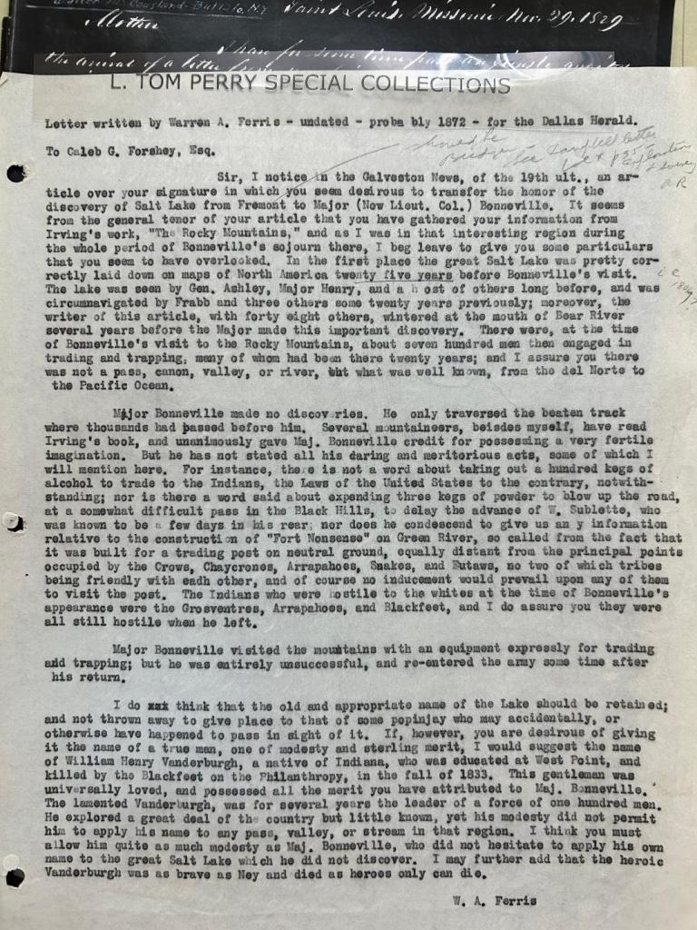
In 1836, Warren Angus Ferris created the “Map of the Northwest Fur Country” which documented the current Salt Lake and surrounding area. The map was based on his explorations while working for the American Fur Company from 1830-1835. The original map is currently held at the B.Y.U. L. Tom Perry Special Collections Library in Provo, Utah. Ferris recorded this area 10 years prior to John C. Fremont’s explorations. Unfortunately, credit for discovering the area has been primarily given to Fremont. Apparently, in 1872, there was discussion to change the applied credit from Fremont to Bonneville. Warren Ferris, was outraged by this and, as a writer for the Dallas Herald, wrote a letter to Caleb G. Forshey, Esq. to challenge this considered change. The remarkable element of this letter is how self-effacing Ferris was. He never boasts about his own accomplishments, instead suggesting that an alternative name of William Henry Vandenburgh be considered. (Please refer to the post about Vandenburgh, an excerpt from “Life in the Rocky Mountains”.)
Interestingly, in the Natural History Museum of Utah, in Salt Lake City, there is a huge map of the Salt Lake area on the floor of the museum. “Lake Bonneville” title is used to demonstrate the outline of the lake. It seems that Ferris’ attempts to make an impact on this subject were not effective.


Leave a comment